When I first wrote The Narrows Escape, the climax was the flash flood - because that was where it happened in real life. Unfortunately, in a work of fiction, that doesn't work. Although there was plenty of action in the second half of the book, there needed to be a climax near the end. This picture from my uncle's slide show helped inspire the climactic ending:
The picture was staged by three of my cousins (Troy, Barry, and Trevor) while at the grotto following the flood, and is one of my favorite pictures from the hike.
Another picture that I drew on for that scene was the picture of the goose egg my dad received:
It was miraculously the only injury we suffered during the ordeal, and I transferred the injury to Brady as he made his mad dash to the finish line over the slippery moss-covered boulders in an attempt to escape the wave.
The next picture is one I took this last summer, visiting the Narrows with my daughter, brother-in-law, and nephew. I staged the triumphant leap to the tree at the end of the trail, the one that Uncle Randy clung to in his effort to escape the tidal wave. Here it is:
Until next time.
Sunday, September 29, 2013
Sunday, September 22, 2013
Virgin Narrows
Now I know that all of you have been waiting to see pictures of the Narrows themselves. Here are some of the pictures Uncle Merlin took 21 years ago following the flash flood that inspired my novel:
The "Narrows" typically refers to the 3.6 mile section of the canyon between the end of the Riverside Walk Trail and Big Springs. In this section, the Virgin River runs wall to wall (often only 20-30 feet apart), with vertical sandstone cliffs (up to 2,000 feet tall) on either side. Although the First Narrows are more narrow in sections, the height to width ratio of the "Narrows" makes them absolutely spectacular. The hike was ranked #5 in National Geographic's rankings of America's 100 Best Adventures.
Unfortunately some of the most spectacular photos from that trip turned out too dark. However, I have been back, and will show more pictures of the Narrows in future posts. Until next time.
Sunday, September 15, 2013
Big Springs
Just before the entrance to the Narrows is Big Springs. It is more than halfway through the hike, and the best place to refill empty water canteens. Here is a picture of the springs:
In the book, The Narrows Escape, the Allreds fill up their bottles before hitting the Narrows. In the scene, Devin steps in a patch of stinging nettle while climbing on the rocks around the springs. That was inspired by a patch of stinging nettle we encountered while climbing around the springs:
Big Springs is also the spot where a momentous decision is made - Devin and Arthur head back upstream to search for Shane, while the rest continue on down the Narrows. In any case, Big Springs is one of the many beautiful spots along the Virgin Narrows.
More pictures to come.
Sunday, September 8, 2013
The Grotto
One of the most unique spots on the Virgin Narrows hike is the cave known as the Grotto. It also plays a major role in the book The Narrows Escape. The Grotto is campsite #8 for backpackers wishing to spend the night in the canyon rather than trying to complete the entire 16-mile hike in a single day. It is one of 12 campsites in the canyon, all located between the First Narrows and the main Narrows. Naturally, a backcountry camping permit is required to stay at the Grotto, or any of the other campsites in the Narrows. Here is a picture of our group at the Grotto:
Unfortunately, because of the flood, we were unable to reach this spot before nightfall. Instead, we slept at this campsite:
I honestly don't know which campsite this is, or if it is even a real campsite. I just know that it was nice to find somewhere reasonably dry to sleep.
In the story, The Narrows Escape, the Allreds end up sleeping at four different locations. Shane ends up sleeping at the Grotto, Arthur sleeps with the rangers and Bob somewhere between the waterfall and the Grotto (in the vicinity of campsites 2-4), Marvin and Trey stay at the bench they climbed to escape the flash flood (before the First Narrows), and the rest of the group camps shortly after the First Narrows (in the vicinity of campsite 1). How did I keep track of everyone and where they were at? I used a map with the major landmarks I downloaded from the internet with approximate distances and times:
http://www.nps.gov/zion/planyourvisit/upload/Narrows%20campsite%20map.pdf
This map was indispensable in mapping out the various scenes and chapters in the book. In any case, I have three of the four groups converge at the area of the Grotto before two of the groups continue on together. What happens to the third group? I guess you'll have to read the book...but I'll give you a clue. It has something to do with the Grotto.
More pictures next time.
Sunday, September 1, 2013
The First Narrows
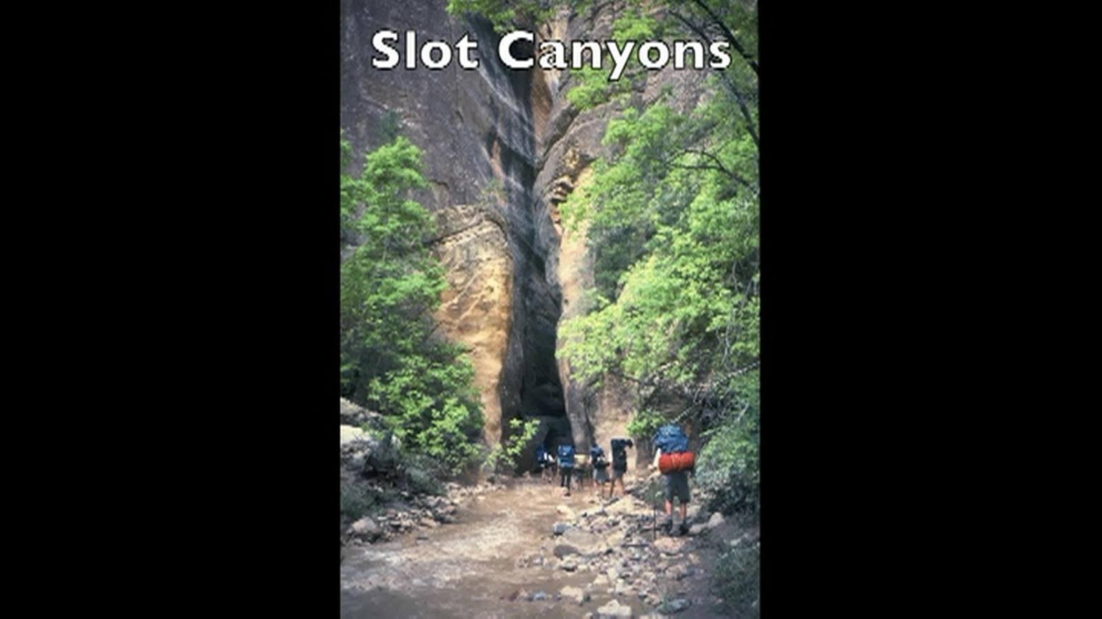
The Virgin Narrows hike in Zion National Park actually has two sections known as the "Narrows." The first section is above the waterfall, and the second section is near the end of the hike. Here is the picture of the slot canyon known as the First Narrows:
This slot canyon is a lot more remote than the main Narrows, which are located at the end of the Riverside Walk Trail. In order to reach the First Narrows, you need to obtain a permit from one of the Visitors Centers within the park. As a result, relatively few hikers of the Narrows ever get to see this canyon - which is actually more narrow than the main Narrows. Here is a picture of the most narrow spot:
Although we couldn't find any spot where we could touch both walls at the same time, we could easily reach the far side with the use of a walking stick. If you look at the walls, you can see the level of the water as it passed through. Here is another shot:
As you can tell, if we had been inside this canyon at the time the flood reached us, we probably would have died. There is absolutely nowhere to go.
More pictures next time!
Sunday, August 25, 2013
The Waterfall
The waterfall is one of the most unique
parts of the Narrows trail. Since the “trail” just above the
falls is primarily the river, some hikers might think it is the end
of the line. Others might think you have to jump twenty feet down to the pool
below. Of course, there is no telling how deep it is or if there are
any dangerous rocks or logs just below the surface. This is a picture
of my brother Greg peering over the falls to the water below:
There is, however, another possibility.
A small trail to the left (if you are heading downriver) of the falls
takes you down the small cliff to the river below. It has been many
years since I've hiked to the waterfall, so conditions may have changed over the years; but the
trail isn't immediately obvious to a first time hiker. Thus, Uncle
Darrell has a little fun ribbing his son and nephews about how to
proceed. Since it would be dangerous to jump into the pool, he instructs them to take the trail down. If I remember correctly, the trail seems to be a type of secret passage - at least that is how Brady views it. Unfortunately, I don't have a picture of it. But, here is a picture of
the falls looking back upstream:
This view makes it look taller than it is, but the waterfall is about 20 feet tall. Still it is quite formidable.
More pictures to come.
Sunday, August 18, 2013
Waiting out the flood
Just like in the book, we stopped and at lunch on a small bank by the river:
Notice, if the flood would have struck at this point, we would not have been on high enough ground to avoid injury. We would have had to run over to the bank where Trevor eventually took refuge and would have probably lost most of our luggage. Here is a picture of the bank where Trevor waited out the flood by himself:
The lunch spot is back around the bend to the left. Right after lunch, we started out again, but Trevor had a feeling to go back. He wasn't sure why, but when he did so, he spotted the flood coming and shouted ahead to us to evacuate. He climbed one bank, and the rest of us scampered up the other. My dad was the last, and we dragged him up the bank with only seconds to spare. After the first 20 minutes or so, some of us began exploring our little "island." Barry and Troy found some broken shale slabs and took turns pretending to be Moses with the 10 commandments:
Then somebody discovered that the cliff wall was honeycombed with miniature caves. We spent much of the rest of the time exploring these holes:
Naturally, this natural phenomenon became part of the story. Shane, stranded over on the other bank, tried to see what the others were doing. As he got close to the edge of his embankment, trying to see better, the dirt started crumbling and... fiction takes over. Up until this point in the hike, most of the events are fairly accurate. From this point on, most of the events are fictitious - but not all. Stay tuned for more pictures.
Subscribe to:
Posts (Atom)


.jpeg)